
Imagine capturing every moment with precision—knowing exactly where you were, what time it was, and even the weather conditions—all stamped directly onto your photos. That’s the power of GPS Map Camera.


In today’s digital age, photography has evolved far beyond simply capturing beautiful images. We now demand context, accuracy, and comprehensive data embedded within our visual memories. Whether you’re a professional surveyor, a travel enthusiast, a real estate agent, or simply someone who loves documenting life’s adventures, having geographical, temporal, and meteorological information attached to your photos can be invaluable.
GPS Map Camera stands out as an all-in-one solution that combines satellite imagery, precise location tracking, local time stamps, and real-time weather data into a single, user-friendly application. This powerful tool transforms your smartphone into a professional geotagging device, adding layers of information that make every photograph tell a complete story. 🌍📸
Why Geotagging Your Photos Matters More Than Ever
Geotagging has become essential in numerous professional and personal contexts. For construction managers documenting project progress, accurate location data ensures accountability and precision. Travel bloggers can share exact coordinates of hidden gems with their followers. Insurance adjusters benefit from timestamped, location-verified evidence of property conditions.
The integration of GPS coordinates, timestamps, and weather information creates a comprehensive digital record that stands up to scrutiny. In legal contexts, this metadata can serve as crucial evidence. For outdoor enthusiasts, it becomes a safety feature—documenting hiking trails, camping spots, and emergency locations with pinpoint accuracy.
Beyond professional applications, geotagged photos enrich personal memories. Years later, you’ll remember not just what you saw, but exactly where you were standing, what time of day it was, and whether the sun was shining or rain was falling. This contextual richness transforms simple snapshots into detailed historical records of your life journey.
Comprehensive Features That Set GPS Map Camera Apart ✨
GPS Map Camera doesn’t just add a simple location stamp to your images. The app provides an extensive suite of features designed to capture every relevant detail about the moment you press the shutter button.
Precise GPS Coordinates and Altitude Data
The application captures latitude and longitude with remarkable accuracy, often down to several decimal places. This precision is invaluable for surveyors, geologists, and anyone requiring exact location data. Additionally, altitude information is included, which proves particularly useful for mountaineers, hikers, and aviation enthusiasts documenting their journeys at various elevations.
The GPS functionality works globally, utilizing satellite networks to pinpoint your exact position regardless of where you are on Earth. Whether you’re photographing the Eiffel Tower in Paris or documenting a remote archaeological site in Peru, the app delivers consistent, reliable location data.
Real-Time Weather Integration 🌤️
One of GPS Map Camera’s standout features is its ability to overlay current weather conditions directly onto your photographs. Temperature, humidity levels, atmospheric pressure, and weather descriptions (sunny, cloudy, rainy, etc.) are all captured and displayed.
This weather data serves multiple purposes. Construction professionals can document environmental conditions during specific phases of building projects. Agricultural specialists can correlate crop conditions with weather patterns. Even casual photographers benefit from remembering whether that stunning sunset photo was taken on a particularly warm evening or during an unexpected cool spell.
Accurate Timestamp and Time Zone Information ⏰
Beyond basic date and time, GPS Map Camera captures local time zone information, which is particularly valuable for international travelers. When you’re crossing multiple time zones during a trip, having accurate local time stamped on each photo helps maintain a coherent timeline of your journey.
The timestamp feature also proves essential for professionals who need to maintain detailed chronological records. Site inspectors, field researchers, and journalists all benefit from precise temporal documentation that can be verified and referenced later.

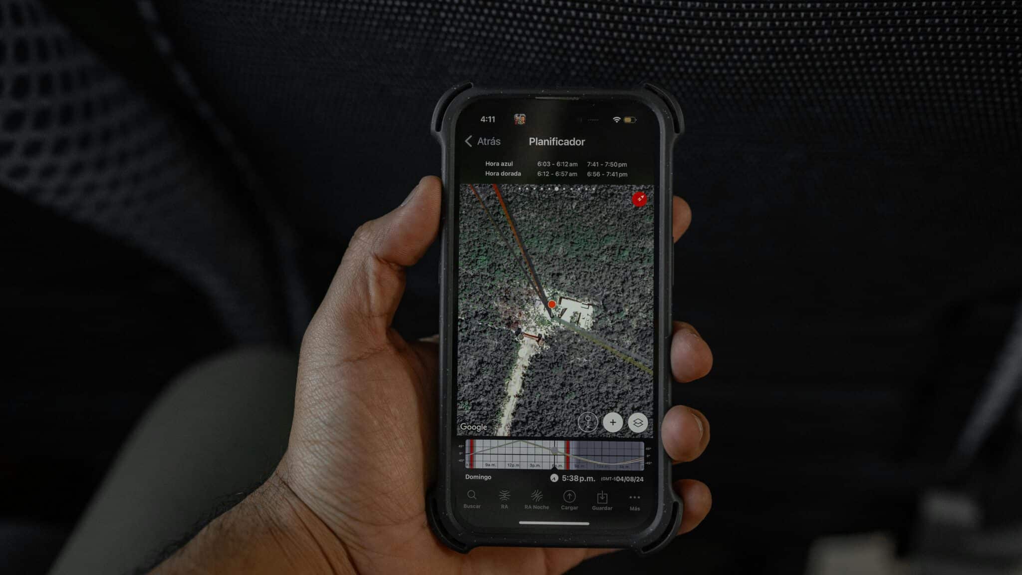
Satellite Map Integration 🛰️
The app seamlessly integrates satellite imagery, allowing users to view their exact position on detailed maps. This feature provides geographical context that pure coordinates cannot convey. You can see your position relative to nearby landmarks, roads, bodies of water, and terrain features.
Different map views—including standard, satellite, and hybrid modes—give users flexibility in how they visualize their location. The satellite view is particularly impressive, offering high-resolution imagery that clearly shows topographical details and environmental features.
Customizable Stamp Layouts and Designs
GPS Map Camera offers extensive customization options for how information is displayed on your photos. Users can choose from various stamp templates, adjust text size and color, modify transparency levels, and position the data overlay exactly where they want it on the image.
This customization ensures that the informational overlay complements rather than overwhelms the photograph itself. Professional users can create consistent branding by applying uniform stamp styles across all their documented images, while casual users can experiment with different aesthetic approaches.
Professional Applications Across Multiple Industries 💼
GPS Map Camera has found devoted users across numerous professional sectors, each leveraging the app’s capabilities to solve specific challenges in their respective fields.
Construction and Engineering
Construction managers use GPS Map Camera to document every phase of building projects. Timestamped, geotagged photos provide indisputable records of work progress, material deliveries, site conditions, and completed installations. When disputes arise or documentation is required for inspections, these detailed photographic records prove invaluable.
Engineering teams conducting site surveys benefit from the altitude and coordinate precision, enabling them to create accurate topographical assessments without carrying additional specialized equipment. The weather data also helps correlate environmental conditions with construction activities and material performance.
Real Estate and Property Management 🏡
Real estate professionals utilize the app to document property conditions comprehensively. Listing photos with embedded location data help potential buyers understand exactly where properties are situated. Property managers create detailed records of maintenance issues, repairs, and property inspections with verifiable timestamps and locations.
Insurance assessors particularly value the app’s ability to create irrefutable documentation of property damage, with weather conditions often playing a critical role in claims processing. The combination of visual evidence, precise location, timestamp, and meteorological data creates a comprehensive record that streamlines the claims process.
Environmental Research and Conservation
Field researchers studying ecosystems, wildlife, or geological formations depend on accurate documentation. GPS Map Camera allows biologists to record exact locations of species sightings, ecologists to document habitat conditions with corresponding weather data, and geologists to catalog rock formations with precise coordinates and elevation information.
Conservation organizations use the app to monitor environmental changes over time, creating visual databases that track ecosystem health, deforestation patterns, coastal erosion, and other ecological phenomena with scientific rigor.
Travel and Tourism Documentation ✈️
Travel bloggers and influencers leverage GPS Map Camera to provide followers with exact information about photographed locations. The embedded coordinates allow audience members to find those hidden cafes, stunning viewpoints, or off-the-beaten-path attractions with precision.
Tourism professionals document attractions, create location-based content, and maintain comprehensive visual records of destinations. Tour guides can build personal archives with detailed contextual information that enhances their knowledge and storytelling abilities.
Enhancing Personal Photography with Contextual Data 📱
Beyond professional applications, GPS Map Camera significantly enriches personal photography by transforming simple images into comprehensive memory capsules.
Creating Detailed Travel Journals
Imagine reviewing your vacation photos years later and instantly knowing not just where each photo was taken, but the exact time, local weather conditions, and even your precise elevation. This contextual richness transforms photo albums into interactive travel journals that tell complete stories.
You can trace your journey geographically, remembering the sequence of locations visited, how long you stayed in each place, and what the conditions were like. This level of detail brings memories flooding back with vivid clarity that ordinary photos simply cannot match.
Safety and Emergency Documentation 🆘
For outdoor adventurers, GPS Map Camera serves as a safety tool. Hikers, climbers, and backcountry explorers can document their routes with precise coordinates and timestamps. In emergency situations, these geotagged photos can help rescue teams pinpoint exact locations, even if communication systems fail.
The app also creates a breadcrumb trail of your adventures, allowing family members or support teams to track your progress through shared photo updates that include comprehensive location data.
Gardening and Home Improvement Projects 🌱
Home gardeners use GPS Map Camera to document plant growth cycles with corresponding weather conditions, helping them understand which plants thrive under specific environmental circumstances. The timestamp feature tracks seasonal changes and growth rates over months or years.
DIY enthusiasts document home improvement projects from start to finish, creating before-and-after records that include when work was completed and under what conditions. This documentation proves valuable for warranty purposes, resale value, and simply remembering the transformation process.
User-Friendly Interface Designed for Everyone
Despite its sophisticated capabilities, GPS Map Camera maintains an intuitive interface that welcomes users of all technical skill levels. The app balances powerful functionality with accessibility, ensuring that advanced features don’t overwhelm casual users while remaining readily available for professionals.
The camera interface is clean and uncluttered, with clearly labeled buttons and straightforward navigation. Customization options are logically organized in settings menus, and helpful tooltips guide users through feature selection. Even first-time users can capture professionally stamped photos within minutes of downloading the app.
Regular updates enhance functionality while maintaining the familiar user experience that existing users appreciate. The development team actively responds to user feedback, continually refining the interface and adding requested features without compromising the app’s core simplicity.
Privacy and Data Security Considerations 🔒
Given that GPS Map Camera handles sensitive location data, privacy and security are paramount considerations. The app operates with transparent data practices, giving users complete control over their information.
Location data is embedded directly into photo files stored on your device—the app doesn’t secretly transmit your coordinates to external servers without permission. Users maintain full ownership of their geotagged images and can choose whether to share them, preserving privacy while benefiting from comprehensive documentation features.
For users who need to share images without revealing precise locations, the app provides options to remove or modify metadata before distribution. This flexibility ensures that professionals can maintain operational security while still utilizing the app’s powerful capabilities for internal documentation purposes.
Maximizing GPS Map Camera’s Potential: Tips and Best Practices 💡
To get the most from GPS Map Camera, consider these practical strategies that enhance both functionality and user experience.
Ensure Optimal GPS Signal Quality
GPS accuracy depends on satellite signal reception. For best results, allow the app a few moments to establish a strong connection when first launching it, especially in new locations. Open sky visibility improves accuracy significantly—tall buildings, dense forest canopy, and indoor environments can degrade GPS precision.
Customize Stamps for Specific Projects
Create different stamp templates for various projects or purposes. For example, maintain a professional template with comprehensive data for work documentation and a minimalist design for personal travel photos. This organization streamlines your workflow and maintains visual consistency across project categories.
Regularly Backup Geotagged Photo Collections
Given the valuable data embedded in your geotagged photos, establish reliable backup systems. Cloud storage solutions, external hard drives, and redundant backup strategies protect against device loss or failure, preserving both the images and their irreplaceable metadata.
Leverage Map Features for Planning
Use the integrated map views not just for documenting where you’ve been, but for planning where you’re going. Survey locations in advance, mark points of interest, and create mental maps of areas you’ll be photographing or documenting.
The Future of Contextual Photography
As technology advances, apps like GPS Map Camera represent the evolution of photography from simple image capture to comprehensive environmental documentation. The integration of location data, temporal information, weather conditions, and satellite imagery creates multidimensional records that serve countless purposes across professional and personal contexts.
Future developments may include augmented reality features, enhanced weather predictions, automatic journey mapping, and even deeper integration with other professional tools and platforms. The fundamental value proposition remains constant: transforming photographs from isolated images into rich, contextual documents that tell complete stories.
For anyone who values precision, accountability, and comprehensive documentation in their photography, GPS Map Camera delivers an impressive suite of features wrapped in an accessible, user-friendly package. Whether you’re documenting construction projects, exploring remote wilderness areas, building real estate portfolios, or simply creating richer personal memories, this all-in-one application provides the tools you need to capture not just images, but complete moments frozen in time and space. 🌟
The convergence of satellite technology, mobile computing, and photography has created unprecedented opportunities for documentation and memory preservation. GPS Map Camera harnesses these technological advances, putting professional-grade geotagging capabilities in everyone’s pocket, ready to transform every photograph into a comprehensive historical record that tells the full story of when, where, and under what conditions each moment was captured.